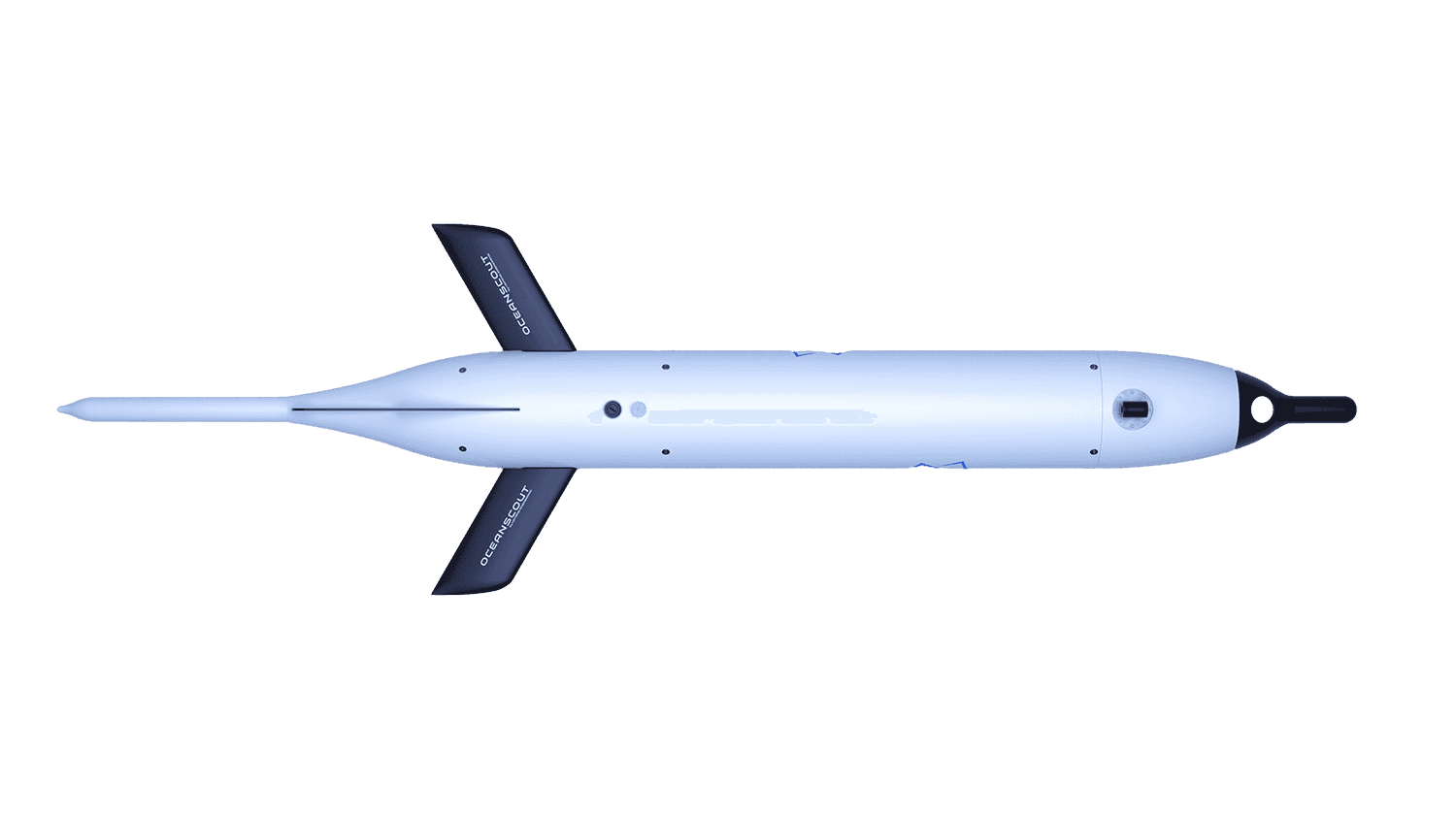
Meet the Oceanscout.
The ocean glider, reimagined.
Hefring Engineering has developed an exceptionally powerful tool for ocean observation and research, setting new standards in the field.
The New Standard
Ocean Gliders
A platform for optimal observation of subsea environments.
Improving Storm Forecasts
Operational use of gliders to measure ocean temperature and salinity for input into forecast models improves prediction of storm intensity and track. Gliders deployed during storms collect this information and send it back in real time.
Marine Mammal Observations
Gliders are an excellent platform for passive acoustic sensors that listen for marine mammals and record the ocean soundscape. The platform is quiet and supports high endurance missions covering large domains.
Battlespace Awareness
Gliders can be rapidly deployed in a region of interest to collect subsurface information, such as sound speed profiles and acoustic signatures, critical to naval operations. This information is then sent in real time by satellite or other means providing immediate maritime domain awareness to decision makers.
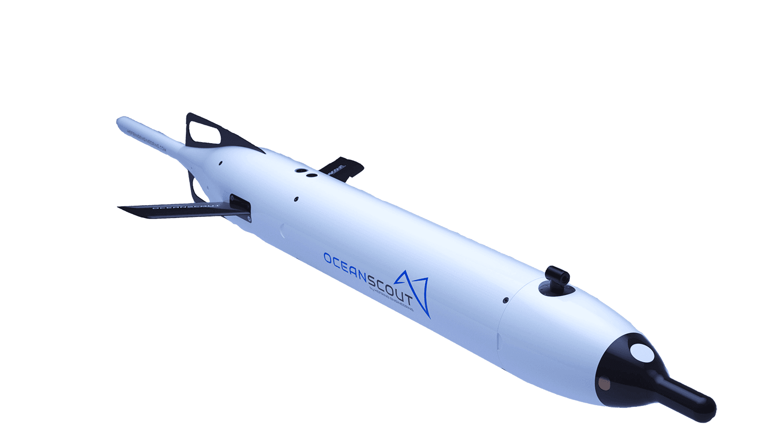
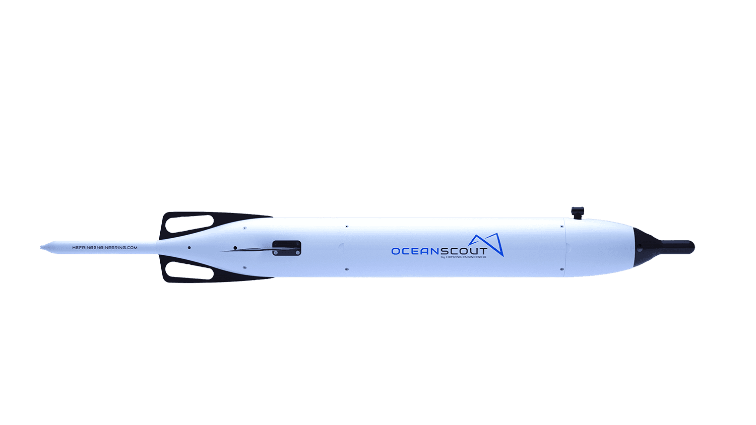
One-person Portable
Discover the possibilities of Oceanscout’s manageable size. Adaptable for single user deployment, Oceanscout is also small enough to load multiple gliders on small craft or autonomous deployment and recovery vehicles.
Hover Mode
Users can set a hover depth for quiet listening beneath the surface. On its way to the next waypoint, Oceanscout can hover in place with motors turned off, minimizing vehicle self-noise, and gather sensor data such as passive acoustic recordings.
Salt to fresh water and back
Oceanscout’s VBE has an exceptionally large displacement relative to glider size and can adjust for about 4% change in density automatically. This allows it to punch through density gradients and provide ultimate flexibility in deployments without ballasting for local conditions.
Uniquely Oceanscout.
One-person Portable
Discover the possibilities of Oceanscout’s manageable size. Adaptable for single user deployment, Oceanscout is also small enough to load multiple gliders on small craft or autonomous deployment and recovery vehicles.
Hover Mode
Users can set a hover depth for quiet listening beneath the surface. On its way to the next waypoint, Oceanscout can hover in place with motors turned off, minimizing vehicle self-noise, and gather sensor data such as passive acoustic recordings.
Salt to fresh water and back
Oceanscout’s VBE has an exceptionally large displacement relative to glider size and can adjust for about 4% change in density automatically. This allows it to punch through density gradients and provide ultimate flexibility in deployments without ballasting for local conditions.
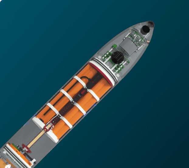
How it Works
Meticulously designed for the mission
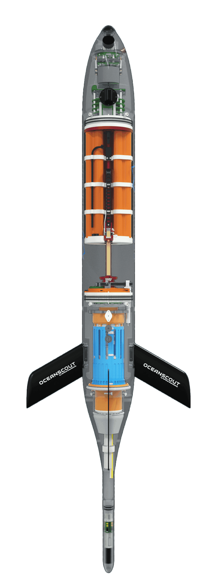
CT Sensor
A CT sensor is standard on all Oceanscout models. It is used to collect sound speed profiles, assimilation data for storm models, and CTD transects. This presents a sustainable paradigm shift in how operational CTD transects are collected around the world.
Altimeter
Oceanscout has a forward altimeter to gauge distance to the bottom to safely maximize profiling range in unknown bathymetries. This is one reason Oceanscout is uniquely able to operate in ultra-shallow conditions (< 6m), an often difficult but critical area to collect information.
Tail
Oceanscout’s tail contains its communications modules, extending its Iridium antenna above the surface and allowing for other communication options, such as radio, if required. Integrated GPS and beacon allow easy location of the glider for retrieval.
Batteries / Pitch and roll assembly
The battery assembly moves fore and aft to pitch the glider and rotates to roll the glider. These steering mechanisms along with advanced algorithms provide Oceanscout with an exceptional ability to stay on course in the presence of currents.
Variable Buoyancy Engine
The variable buoyancy engine acts to rapidly change glider density to propel the glider up and down through the water column. Oceanscout’s VBE has an exceptionally large displacement relative to glider size and can adjust for about 4% change in density automatically. This allows it to punch through density gradients and provide ultimate flexibility in deployments without ballasting for local conditions.
LED status indicator
This is a user-controlled color-coded external verification of glider operating status. Deploy Oceanscout with confidence, knowing that it is properly on its way to the intended mission.
Power to get you all the data you need.
With the economical, standard 1.8 KWh Lithium Battery Pack, Oceanscout has changed the total cost of ownership/operations cost for glider users. More missions are possible. The standard battery pack will power Oceanscout for 1 month depending on configuration. Battery packs can be quickly and easily replaced by the user.
Information to shore
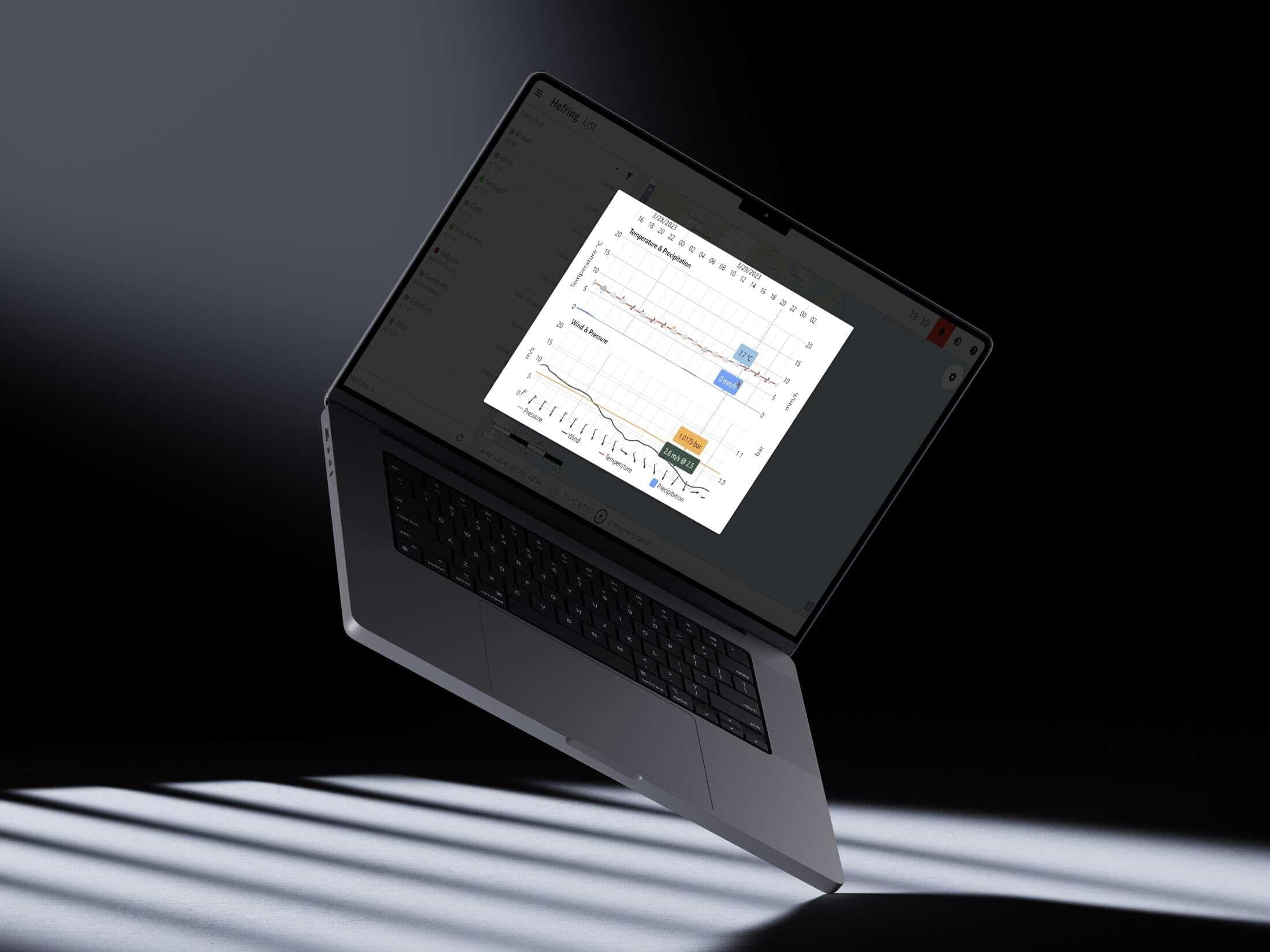
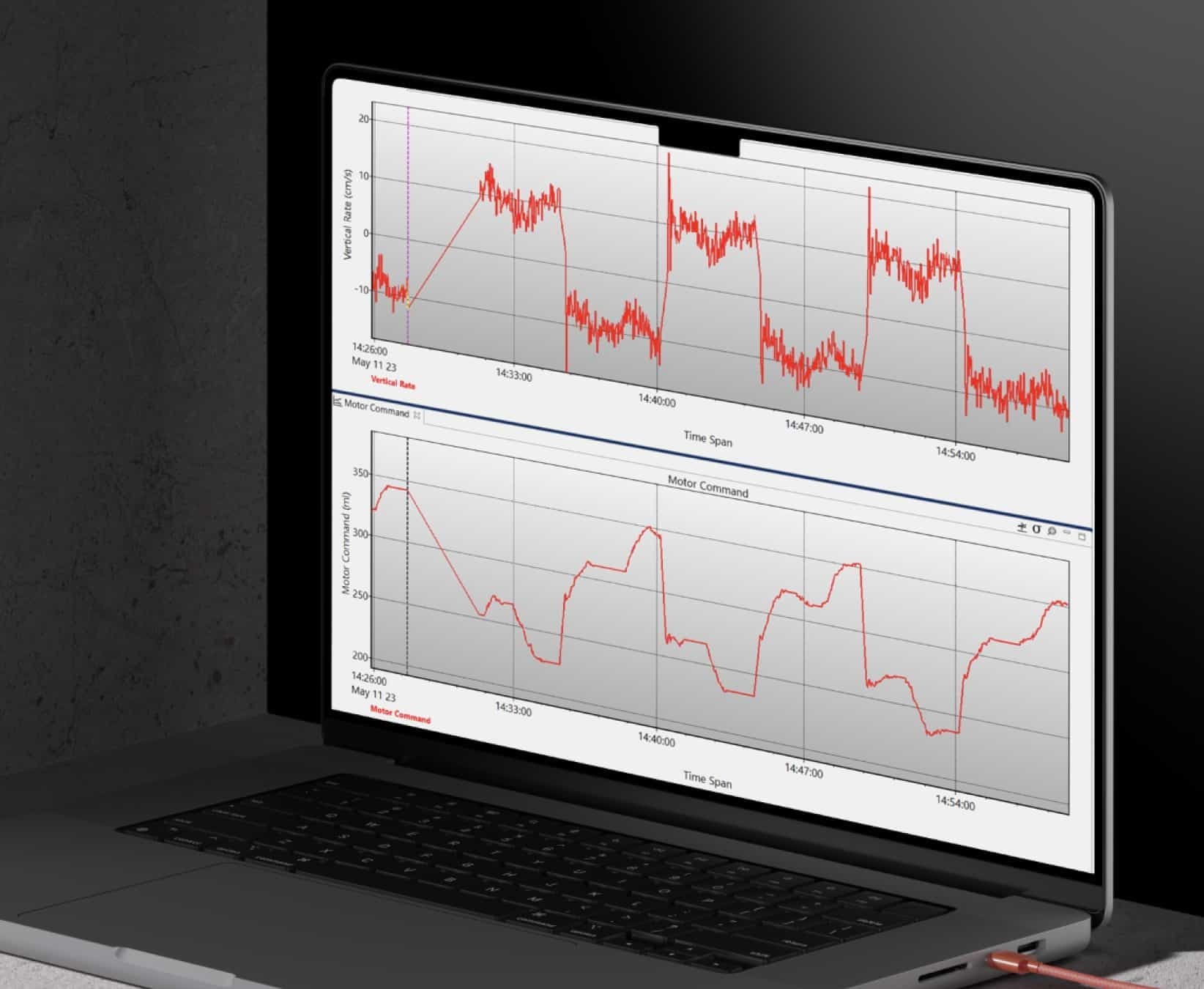
Real Time Information
Our software is designed to provide you with real-time information about your location, route, battery status, and remaining disk space for data collection. Oceanscout offers live dive summaries, CTD data, and PAM data.
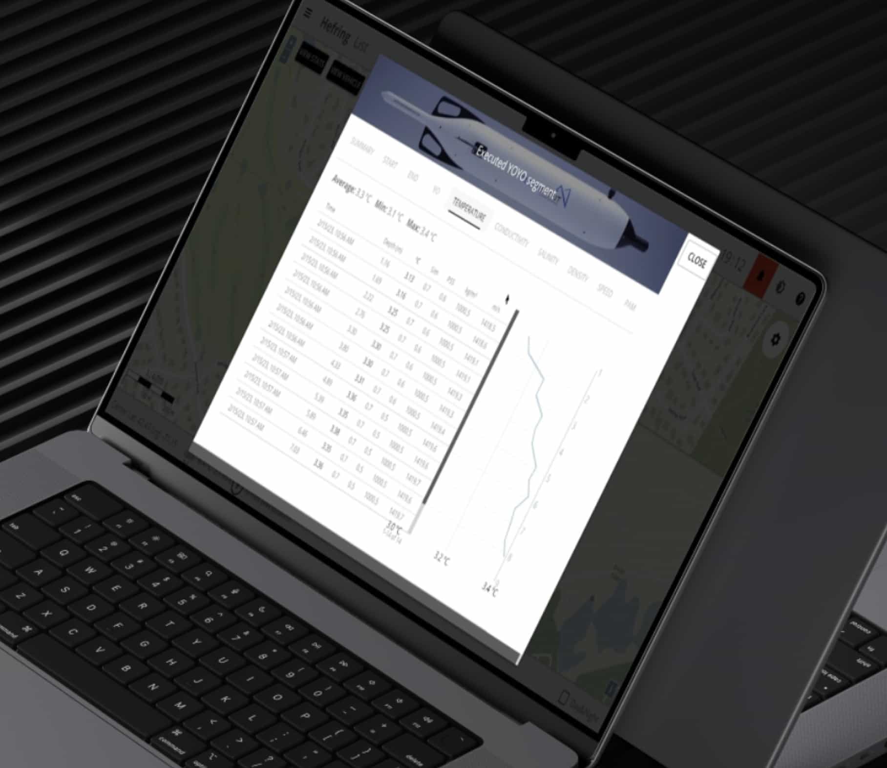
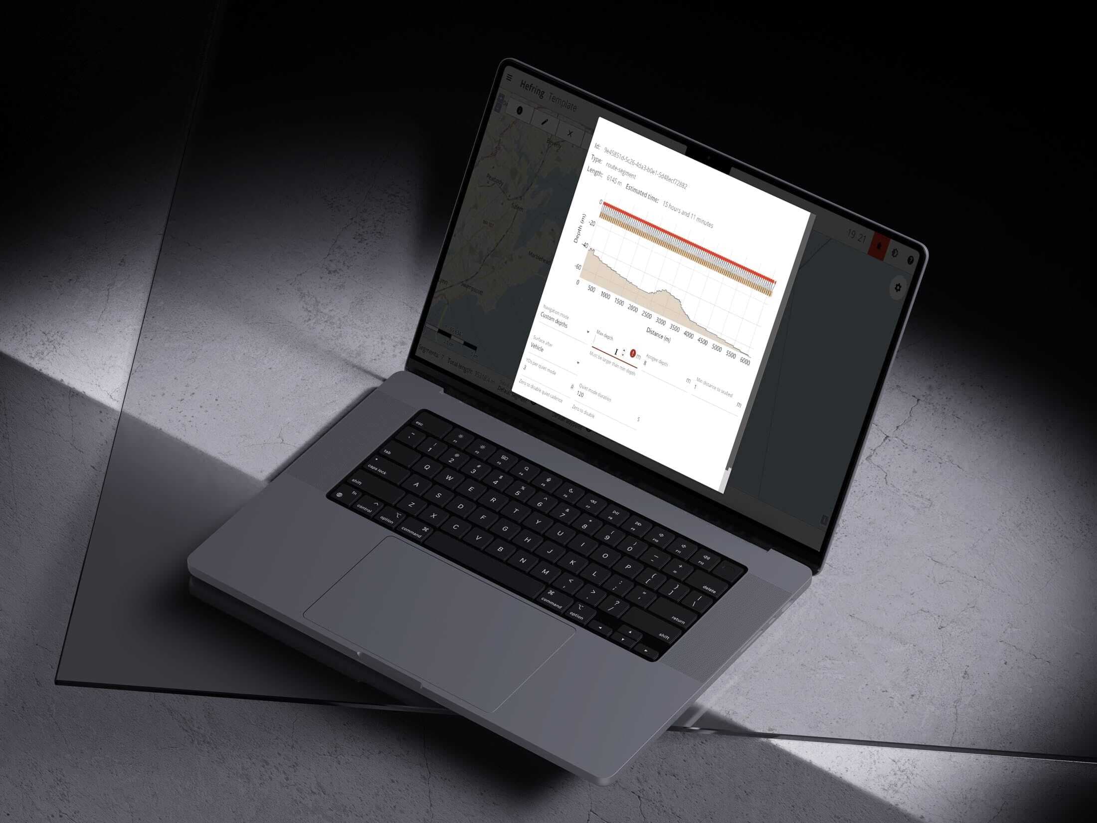
All the Data
Upon retrieval, full data sets can be downloaded. PAM data can be retrieved by removing the two 1TB SD cards from the glider. CTD and navigation data can be viewed and analyzed.
Welcome to Oceanscout.
Request a quoteMission Report
Gulf of Mexico Demonstration
An experienced glider user and prospective Oceanscout customer asked the team to demonstrate the system’s capabilities in their waters to assess if it could expand their measurement capabilities.
Learn more
Spec Sheet
Reinventing The Ocean Glider
Hefring Engineering is re-imagining one of the most versatile tools in ocean observation and research.
Learn more
Event
See Oceanscout at COVE Demo Day 2023!
We will be at COVE Demo Day with Oceanscout on display. Since COVE’s demonstration areas were too shallow or not visible enough for a glider...
Learn more
Resource
Oceanscout featured in Unmanned Systems Technology magazine
Peter Donaldson finds out how this buoyancy-driven UUV removes the key barriers to widespread scientific research in our oceans.
Learn more